The walk takes you through many of the various shopping districts in the centre of London, from the mass market Oxford Street to the small specialist districts. It’s a linear walk starting at Goodge Street.
The first few districts visited are very much specialist, if these are not of great interest or you know you want to spend time in the more mainstream districts towards the end of the walk, it’s easy to start the walk at many points along the route.
It’s unlikely if you are an avid shopper that you would complete this walk in a day, so we recommend you read through and improvise on what attracts you particularly.
This is stage one of the walk. Please also see Stage 2 Leicester Square to Harrods via Oxford Street.
These guides focus on the practical aspects of the walk and do not aim to replace a comprehensive guidebook for London. With a reliable London street map or a mapping app on your phone, you’ll easily navigate this route and feel free to make interesting detours and adjustments along the way.
London Shopping more information
Self guided London shopping walk map
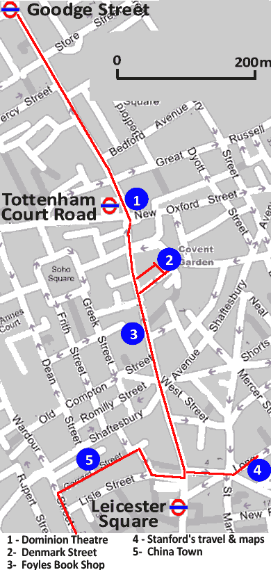
Starting from Tottenham Court Road
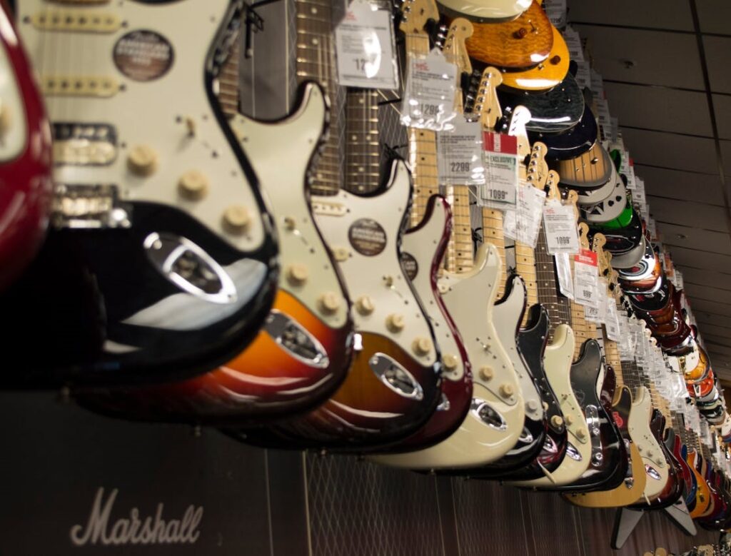
From in front of Goodge Street Underground Station turn south down Tottenham Court Road, against the flow of the one-way traffic. The southern end of Tottenham Court Road holds London’s biggest concentration of electronics shops, from hi-fi, to cameras, vision and computer equipment.
The shops line either side of the road for about 500m, until you come to the Dominion Theatre on your left hand side with the junction of Oxford Street. They constructed the Dominion Theatre in 1929, and it has since become a venue for musicals, continuing a rich tradition in musical performances. In 1957, Bill Haley & His Comets were the first US rock and roll band to play the UK.
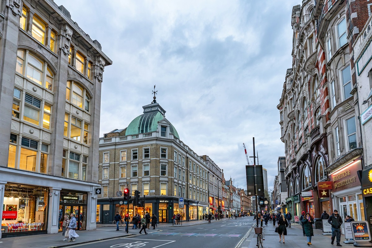
Tottenham Court Road Underground is at this junction. The department stores of Oxford Street are at the western end. We visit these at the end of the walk.
Denmark Street, music
After about 150m from the junction with Oxford Street, Denmark Street branches off Charing Cross Road to the left walking south.
Denmark Street is the centre of Britain’s modern music industry. The relatively short street and alleyways contain musical instrument shops, recording studios and music publishers. There is a slightly seedy atmosphere, but for the music enthusiast a very interesting part of London.
In number 20 Denmark Street, Elton John worked as an office boy. At the same address Paul Simon failed to sell his catalogue of songs that included later hits like ‘Homeward Bound’ and the ‘Sounds of Silence’. At number 4, the Rolling Stones recorded their early albums and Elton John also did early work here.
Explore the alley on your left and you will come across a noticeboard full of notices from bands looking for extra members as well as some more recording studios.
Visiting Denmark Street with London Rock Tours – more info
Charing Cross Road and Cecil Court – books

Cross Shaftesbury Avenue past the Palace Theatre on your right.
What Tottenham Court Road is to electronics, Charing Cross Road is the equivalent for books. Foyles is one of the largest shops, delightfully eccentric and a million miles from some of the chains around.
The road was immortalised in the book ’84 Charing Cross Road’, also a successful play.
The book was based on a real book shop that was visited by such immortals as Charlie Chaplin and George Bernard Shaw. Perhaps the hey day has passed, but for book lovers it’s still a great place to loiter.
Just south of Leicester Square (and just off the map above) is the popular Cecil Court, which featured in the 1987 film of ’84 Charing Cross Road’. Cecil Court is a quaint old fashioned street filled with old fashioned (and in many cases, unusual) bookshops.
Cecil Court is a popular stop on the Harry Potter walking tours.
Harry Potter Walking Tour for Muggles
Stanfords – Travel Books & Maps
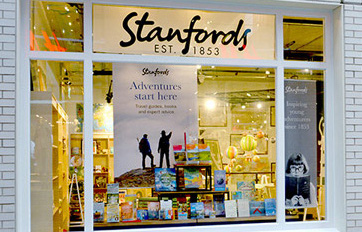
If you have an interest in travel or maps then Stanfords is well worth a detour and should not be missed. Turn left (2nd turning after Shaftesbury Avenue) into Great Newport Street which brings you to a junction of six roads.
Long Acre is the main road directly opposite Great Newport Street. Stanfords is at number 12, a little way down on the right (just off the map above).
This is a specialist travel map and book shop. If it isn’t here, then it’s probably not available. The British section is extremely worthwhile if you’re planning on touring the rest of the UK.
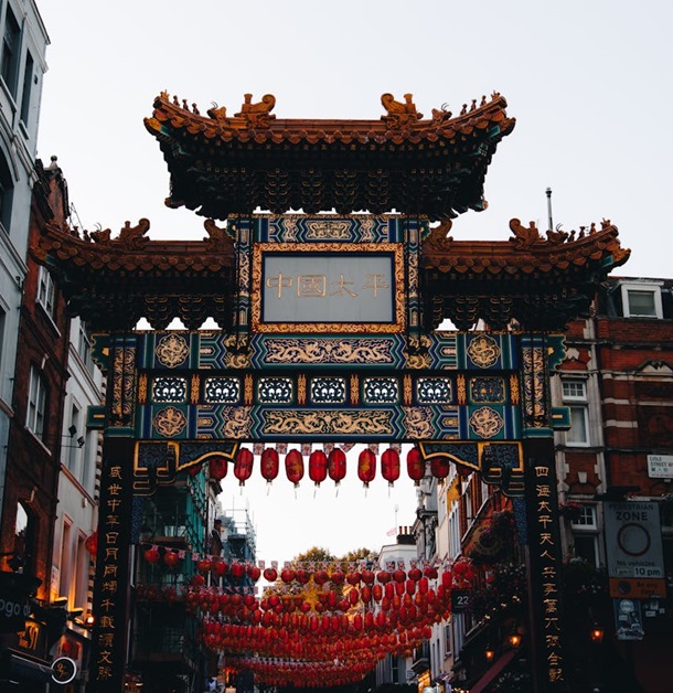
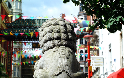
Gerrard Street – China Town

On the opposite side of the road from the Great Newport Street turn off, a few yards south along Charing Cross Road is Lisle Street.
Turn into Lisle Street and you are now in London’s China Town, Europe’s biggest.
Turn next right into Newport Place, then left into Gerrard Street. The street has Chinese street furniture including a gate. Gerrard Street is the main street of China Town. You will find restaurants, acupuncturists and Chinese medicine shops, tea houses as well as other retailers managed by the Chinese community.
Explore the China Town area. When you have finished exploring make your way to the opposite end of Gerrard Street to that which you entered, (western end).
Turn left into Whitcomb Street. Then right into Coventry Street. You are now in Leicester Square.
Stage 2 of our walk continues visiting Oxford Street, Carnaby Street & Harrods amongst others.
This is the end of stage one of our London shopping walk.
To continue your journey please visit:
Stage 2 Leicester Square to Harrods via Oxford Street